
Uncharted Territory
Jaime Winston BA ’22, Marketing & Communications
It’s hard to imagine Utah without its Great Salt Lake.
The lake has existed in — more or less — its current form for the past 11,000 years.
It was an important landmark for the Ute, Goshute, Shoshone and Paiute nations before white settlers arrived.
Spectacularly preserved petroglyphs cover rocks on Stansbury Island.
Brigham Young is said to have remarked “This is the right place; drive on” upon viewing the lake and surrounding valley before founding Salt Lake City.
Today, as the largest saltwater lake in the Western hemisphere, it’s a major tourist destination, supports a thriving brine shrimping industry, houses migrating waterfowl and shorebirds, and serves as a breeding ground for songbirds.
Unfortunately, the state’s distinctive landmark has been drying up.
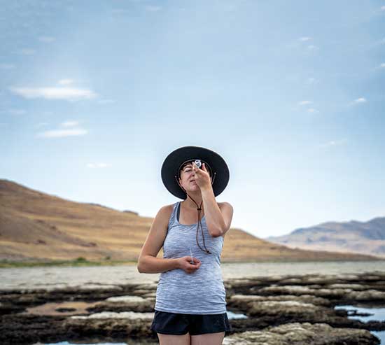
Carie Frantz, WSU associate professor of Earth and environmental sciences, leads student researchers in examining the impact of the lake’s declining water levels and increased salinity. While she admits the outcomes of the lake drying up are not a certainty, what could likely occur is frightening.
The food chain relying on the lake’s microorganisms and brine flies could be broken. Humans could be impacted, too, since a “toxic dust soup” could be kicked up into the air.
A Tipping Point
“We’ve entered uncharted territory,” Frantz said. “It’s at a scary tipping point right now, and we don’t know what’s going to happen.”
Frantz attributes the Great Salt Lake’s lower water levels to a megadrought gripping the southwestern United States, global climate change and overuse of water from the Jordan, Weber, and Bear Rivers that would otherwise flow into the lake.
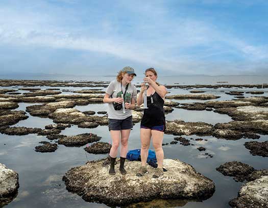
For the past two summers, she led the GETUP Summer Research Experience, giving geoscience students the chance to research the impact of the lake’s water and salinity levels on the ecosystem as full-time research assistants.
Frantz and her students collect lake samples at Antelope Island and analyze them at Weber State. At the end of the program, the students present their results at a symposium, and some serve as peer mentors in the GETUP Summer Bridge Program, a hands-on learning program for first-generation or low-income students interested in geoscience and environmental science who plan to attend Weber State.
 Maggie Nguyen, a geology major, learned about last summer’s GETUP program from Marek Matyjasik, Department of Earth and Environmental Sciences chair.
“I want to go into hydrology and look at water systems,” said Nguyen, who will graduate in 2024. “So, monitoring and researching the Great Salt Lake directly ties into that.”
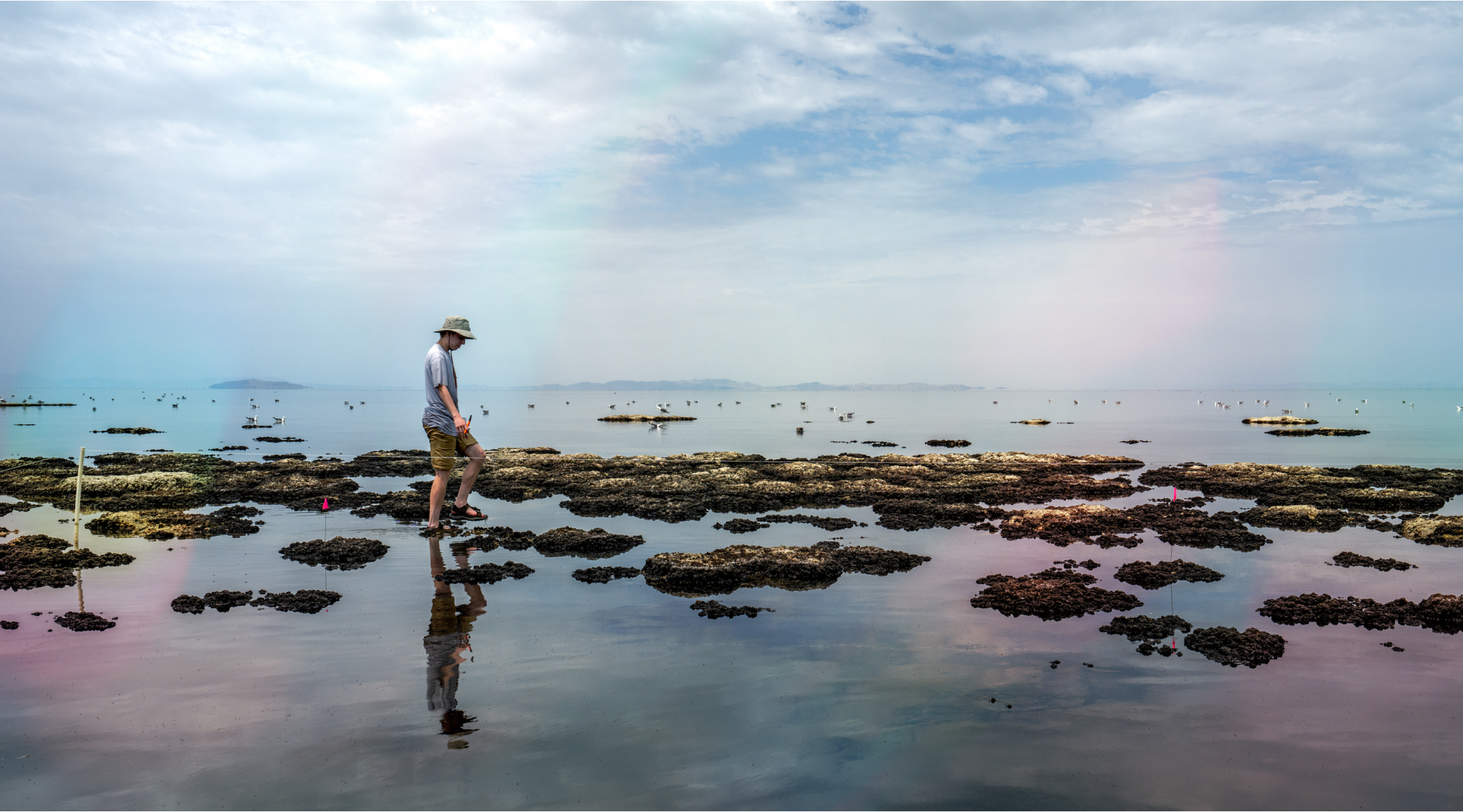
Over the summer, Frantz led Nguyen and five other students in studying microbialites, rock structures that house photosynthetic microorganisms that are an important food source for other organisms in the lake. As the lake dries and more microbialites are exposed to the air, the organisms on them no longer contribute to the lake’s food chain, impacting brine shrimp, birds and other animals.
Since 2012, over half of the microbialites in the lake have been exposed.
Nguyen warns that the drying of the lake could also put dust from the lake bottom into the air, possibly harming air quality for anyone downwind.
“Have you noticed that when it rains and it dries there’s this film on your car?” she asked. “That’s from the dust that gets suspended into the air, and the more the lake dries up, the more that sediment gets suspended into the air.”
Usually seen in winter inversions, Frantz said Utahns should expect to see more of that “particulate matter pollution” year-round, and it’s possible the dust may contain high concentrations of metals above EPA levels, including arsenic. Some of the metals have entered the lake through agriculture, mining and industrial discharge.
“There’s a bunch of other metals of concern as well in Great Salt Lake sediments, so it’s basically a ticking time bomb of health hazards sitting out there,” Frantz said.
 Another Cause for Concern
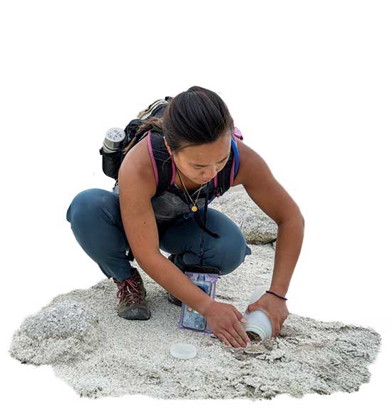
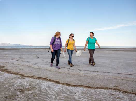
Since 2019, Rebecka Brasso, associate professor of zoology, has also led Weber State students in studying the lake’s ecosystem.
Each summer she brings students to Antelope Island to collect brine flies and western spotted orb weaver spiders — an increasingly difficult task.
“I have been shocked by the degree the water level in the lake has changed over the past four years,” Brasso said. “A few years ago, it was a half mile walk to the edge of the water to collect flies at one location. This year, the walk is almost a mile.”
She continually changes her plans, as spiders or flies in one area may not be in the same spot the next year, or month, as the shoreline moves farther away.
Brasso is concerned with the potential loss of localized populations of invertebrates that are important food sources for breeding birds.
“As these invertebrates make up the near entirety of the Great Salt Lake aquatic food web, species that rely on their abundance are at great risk of low food levels or starvation,” said Brasso, adding that millions of birds prey on the shrimp and flies.
After collecting spiders and flies, Brasso and her students analyze their mercury levels at Weber State labs. Their goal is to create a long-term data set to track the changes in the lake’s mercury availability. They have found mercury levels in brine flies increase from June to August, and, with lower water levels, suspect mercury concentrations could increase year to year. “Mercury concentrations in orb weaver spiders that consume brine flies seem to depend on the availability of brine flies near their webs,” Brasso said. “The spiders build webs in shrubs that are usually along the water’s edge, but are now increasingly distant, making this food resource less abundant, altering the mercury exposure.”
Wetlands, like those surrounding the lake, are known to be “mercury hotspots,” Brasso said, adding that the likelihood of methylmercury, a more toxic form of mercury, being produced increases as water levels begin to go down. “The main question now is ‘what will this mean for the movement of mercury from the Great Salt Lake into the associated terrestrial food webs?’ It could go up or even down,” she said.
Even low levels of mercury have been known to affect reproductive success, Brasso said, "meaning the birds feeding on the brine flies could be laying and hatching fewer eggs, and having fewer chicks that will survive."
 What Can We Do?
While it may not fix everything, Frantz strongly encourages Wasatch Front residents and organizations to take part in water conservation efforts.
Weber State University is heeding the advice. The university has reduced its total water use per acre by 40.3% compared to a 2016–2018 average baseline, while the university has grown by 265,699 square feet from the baseline years.
Drew Hodge BS ’16, water conservation and stormwater coordinator, developed the university’s Water Action Plan, which offers best practice guidelines. Along with consulting for renovations and new construction projects, Hodge works with WSU’s in-house landscaping team on two xeriscape projects each year and the Water Warrior program, a competition among landscapers to conserve water.
“We’ve got some cool projects,” he said. “We are in the process of switching our cooling towers over to secondary water. They have historically been run on culinary water.”
Stormwater collected on the Ogden campus is retained in WSU’s duck pond. Pollutants in the water settle at the bottom of the pond before the water is used for other purposes. Hodge and his team are working on a project to deepen the pond, which will make the water in the pond cleaner by allowing it to circulate more efficiently.
“With the added water, we can use it more effectively,” he said. “This allows us to use less irrigation water on campus, and, with the pond water quality improving, it will be better for Ogden City as well as the Great Salt Lake.”
 Weber Basin Conservancy District, which serves Davis, Weber, Morgan, Summit and a portion of Box Elder counties, restricted residential irrigation to two days per week for unmetered customers during the summer. Those with meters were restricted by a certain volume each month based on their contract with the district.
In addition, residents could take part in the Flip Your Strip program, which incentivized them to replace grass parking strips with rocks and/or water-wise plants.
Darren Hess, assistant general manager and COO of the conservancy district, said although soil moisture and runoff levels were higher this year than the previous, he sees a need for continual conservation as Utah becomes an even drier state. However, he said just diverting more water to the lake may not fix the problem, since so much evaporates due to the lake’s low depth and wide surface area. “It’s like pouring water on a plate versus a bowl,” he said. “We likely need help from Mother Nature to put us into a wet cycle where we can fill our reservoirs and then spill them to the Great Salt Lake.”
However, anything done to help save water can benefit, if not save, the lake.
Students like Nguyen are learning about this first hand.
“If we don’t change our ways, then the lake will continue to dry up and things will start to spiral,” Nguyen said. “As pessimistic as that is, I think it’s the truth.”
Salt Lake Water Elevations
The United States Geological Survey has measured lake surface elevation levels (feet above sea level) 3.4 miles northwest of Saline, Utah, in the Great Salt Lake, since the 1960s.
A decline in elevation has been shown over the last several decades.
Jan. 1, 1990: 4,203.8
Jan. 1, 2000: 4,202
Jan. 1, 2010: 4,193.69
Jan. 1, 2020: 4,193.1
Measurement as of Jan. 1, 2022: 4,190.3.